Category:DEM maps of Landkreis Nordhausen
Jump to navigation
Jump to search
Media in category "DEM maps of Landkreis Nordhausen"
The following 9 files are in this category, out of 9 total.
-
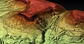
 Allzunah-Burgen Geländemodell.jpg 1,920 × 1,080; 1.23 MB
-
 Burgruine Kirchberg an der Hainleite Geländemodell.jpg 1,920 × 1,080; 1.35 MB
-
 Rauchenberg an der Hainleite.jpg 1,920 × 1,017; 1.18 MB
-
Rauchenberg an der Hainleite.webm 24 s, 1,280 × 678; 2.06 MB
-
 Wöbelsburg bei Hainrode an der Hainleite.jpg 1,920 × 1,017; 1.37 MB
-
 Wöbelsburg Nahaufnahme aus Richtung Norden.jpg 1,920 × 1,017; 1.26 MB
-
 Wöbelsburg Nahaufnahme.jpg 1,920 × 1,017; 1.2 MB
-
 Zengenberg an der Hainleite.jpg 1,920 × 1,017; 1.18 MB
-
Zengenberg an der Hainleite.webm 24 s, 1,277 × 676; 1.88 MB


